Echigo Country Trail 63km Course Introduction【Part 1】
The 63km course is the main course of the Echigo Country Trail.
It makes a large loop through the satoyama landscapes of Oguni Town in Nagaoka City, and finally climbs Mt. Hachikoku, the highest peak in Oguni.
Starting from Oguni Forest Park, the course runs through the Oguni Basin and passes through a variety of landscapes — open fields, satoyama trails, ridge paths, small villages, and back into the mountains again.
One of the attractions of this course is the constantly changing scenery and terrain. Even over the long distance, the course has a natural rhythm that lets runners fully enjoy running through the satoyama landscape.
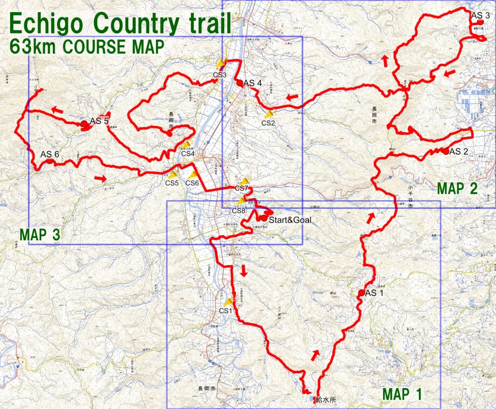
Next, we introduce the section from the start to around Aid Station 1 in MAP1.
This section begins with a pleasant road through the countryside before gradually entering the satoyama hills.
Local cheering spots along the route and the peaceful rural scenery are also part of the unique charm of Echigo Country Trail.

The rest of the course will be introduced in Part 2 (MAP2 & MAP3) in our next post.
Registration for the Echigo Country Trail is now open.
We look forward to welcoming many runners to Oguni!