Please Use the GPX Data (Course Marking Information)
It is now June, and Echigo Country Trail 2026 is only two weeks away!
This weekend, members of our race operations team completed course marking throughout the race routes.
The Echigo Country Trail course includes not only trails, but also public roads and farm roads. Because of this, different types of course markings are used depending on the location. Please familiarize yourself with the markings below before race day.
In addition, we strongly recommend downloading the GPX data to your GPS watch or smartphone before the race rather than relying solely on course markings.
Types of Course Markings
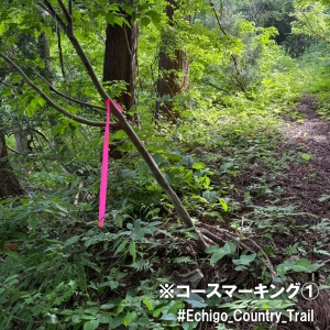
①Pink Tape
Pink tape is attached to trees and branches along trails, forest sections, and farm roads.
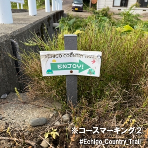
②Green Arrow Signs
Green arrow signs are placed at intersections, farm roads, and along paved roads.
Please note that these signs are relatively small (approximately 20 cm high), so be careful not to miss them.
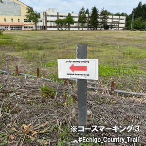
③Red Arrow Signs
Like the green signs, red arrow signs are placed at intersections, farm roads, and along paved roads.
These signs are also fairly small, so please pay close attention to your surroundings.
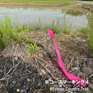
④Stakes or Pegs with Pink Ribbon
These are mainly installed along farm roads and paved roads.
Although they are positioned low to the ground, the bright pink ribbon makes them easy to spot.
Please Use the GPX Data
During the race, it is easy to miss course markings while focusing on your footing or following other runners.
Because Echigo Country Trail includes sections on public roads and farm roads, it is important to both:
- Follow the course markings
- Check your location using GPS
Please download the GPX data from the official website and load it onto your GPS watch or smartphone before the race.
Thank you for your cooperation. We hope everyone enjoys a safe and successful race.